Google Earth AI Fiasco Underscores Why Tech Firms Must Listen to Outside Experts
shirin anlen, Sam Gregory / Jul 31, 2026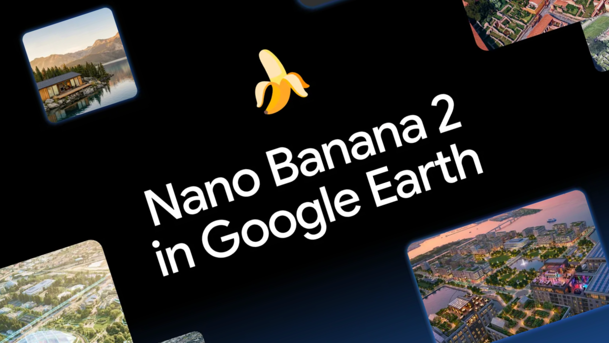
Screenshot from a Google announcement.
On Thursday, Google announced an update to Google Earth, giving users the ability to use its Nano Banana image generation capabilities to “transform” real world locations. After public outcry, on Friday the company rolled back the new feature in order to work on “implementing stronger guardrails.”
The incident is just one more parable in a long line of product releases by AI firms with potentially dangerous consequences for information integrity. In this case, Google didn't just add AI to Google Earth. It briefly changed one of the world's most trusted sources of evidence. For more than two decades, Google Earth has earned the trust of journalists, human rights investigators, open-source researchers, and even courts. Not because it is flawless, but because it provides a stable, time-stamped record of the physical world.
That credibility has made it part of the global verification infrastructure. By integrating generative image creation, Google threatened to fundamentally change that relationship. Google Earth was no longer just a record of reality, but also a generator of plausible realities, collapsing the boundary between one of the world’s most trusted reference systems and a generative AI system.
This episode revealed something much bigger than a single product mistake. It showed how easily generative AI can undermine the trust embedded in public information infrastructure when governance fails to keep pace and when companies prioritize commercial and consumer priorities over reality resiliency. And it is just another point of evidence as to why companies like Google must more actively engage with the civil society experts who could have seen this coming.
At WITNESS, we warned about exactly this in our 2024 report on generative AI and conflict. One of the key risks we identified was the ability to generate synthetic evidence of military operations, humanitarian crises, and damaged infrastructure tied to real places, making verification during conflict substantially harder.
We have already seen how this plays out. For example, during the recent Iran-Israel-US war, AI-generated satellite imagery purporting to show destroyed US military infrastructure spread widely online. The fabricated images were built from authentic Google Earth imagery of a US naval base in Bahrain, adding convincing synthetic destruction while preserving real geographic features. They accumulated hundreds of thousands of views before BBC Verify and other investigators established they were fake. None of this should have come as a surprise. We argued about this in our December 2025 Reuters Institute article on how AI is undermining OSINT's core assumptions, and researchers like Henk Van Ess have demonstrated exactly how these risks emerge in practice.
The greatest risk is not a single convincing fake. It is the normalization of ambient uncertainty: an information environment where authentic evidence, synthetic media, misleading forensic analyses, and faulty AI detection results circulate together until distinguishing reality becomes increasingly difficult.
Across our investigations during the Iran-Israel-US war, we saw exactly that. Genuine evidence was dismissed as AI. Fake evidence was used to illustrate real events. Technical-looking analyses were weaponized to undermine authentic reporting. The objective was no longer to convince people of a lie; it was to make reality itself feel unknowable.
Google’s rollback should be welcomed. But pausing one feature does not resolve the deeper issue that its brief deployment exposed. Google promoted the capability with examples like creating "a rendering of your future house nestled perfectly in the actual landscape." But products should not be evaluated solely by their intended use cases. They must also be judged by their foreseeable misuse. In this case, the potential misuse cases made it obvious that meaningful consultations with media and civil society organizations would have identified them before launch.
And companies like Google also have a responsibility when they recklessly expand the Overton window on what is acceptable or normal to manipulate. It’s true that it doesn’t require a Google tool to manipulate a satellite or geo-image—and that satellite and geospatial images were photoshopped before this (as exposed by Bellingcat in its MH 17 investigations), and also that other tools could be used to achieve similar results. Satellite imagery has been a target of concern in deepfakes analysis and detection since the earliest days. But there is an enormous difference between something being technically possible and being seamlessly integrated into one of the world’s most trusted geographic platforms. By making this capability native, frictionless, and globally accessible, Google dramatically lowered the barrier to producing location-based fabrication while normalizing manipulation on a hitherto relatively ground-truthed source.
The problem is compounded by a verification ecosystem that is already struggling to keep up with the increasing volume and variety of synthetic content. Today's AI detection systems were largely built to identify manipulated faces and biometric signals—not synthetic environments, landscapes, damaged infrastructure, smoke, satellite imagery, or disaster scenes. As we recently argued, the verification ecosystem is fundamentally mismatched to the kinds of deceptive content that increasingly matter in conflict, climate disasters, and humanitarian crises.
This is also a verification ecosystem where plausible deniability is routinely deployed to dismiss real content as artificially generated. The history of satellite imagery in human rights work is of its use to prove war crimes in Sudan and Myanmar; competing with falsified images from the ground that claimed to prove events didn’t happen or that the perpetrators were different. Now, the satellite imagery can be generated to reinforce the lie, and the ‘liar’s dividend’ deployed to dismiss what has been a hitherto trusted source.
Perhaps most striking is how casually this capability was introduced. Google's initial response emphasized safeguards largely focused on downstream mitigations such as SynthID watermarking and content restrictions. Those are useful measures, but they are not an adequate governance strategy. Products that become part of the world’s verification infrastructure require fundamentally different standards for deployment––this is a feature that reshapes one of the world's most trusted sources of visual evidence, and that places yet another assumption of ‘must verify everything you see on the internet’ upon us all.
Platform capabilities with this level of societal impact demand rigorous pre-deployment risk assessments, meaningful consultation with affected communities and civil society experts, and safeguards proportionate to the risks. Watermarking is an important mitigation, but it is not a substitute for responsible product design. In the real world, images are screenshotted, cropped, compressed, reposted, and stripped of provenance within minutes. They leave Google's ecosystem almost immediately, while the burden of sorting truth from fiction falls on journalists and investigators using verification tools that already struggle to analyze precisely this type of content.
That is exactly backwards. The burden should not fall on verification communities to absorb the consequences of increasingly powerful generative systems while tech firms profit. Companies introducing technologies that reshape the evidentiary landscape should have to demonstrate that they can be deployed safely before they become globally available, not ask the rest of the information ecosystem to adapt after the fact. Google’s decision to pause the feature suggests those concerns are now being taken seriously. The question is why they were not central to the product development process from the outset.
Google Earth will almost certainly remain an invaluable public resource. But by merging trusted geographic reference imagery with on-demand AI generation, Google risked changing more than a product. It threatened assumptions that underpin visual verification itself. If companies want to build tools that become part of the world's information infrastructure, they must stop treating them as consumer creativity products, and must be governed accordingly as systems that shape public trust, reporting, and accountability.
So what comes now? Google says it will work on better “guardrails.” But are guardrails enough when the fundamental accessibility, ease and promotion of the tool itself undermine our shared trust infrastructure in favor of novelty, humorous overlays, dicey fakes and easier real estate visualization?
Authors